5 May 2022
PRODUCT UPDATE RELEASE NOTE - HX-2 GPS NAVIGATOR - MAY 2022
Introduction:
Based on customer feedback, the Hema-X development team and our mapping team have been hard at work continuing to make enhancements to the maps and functionality of the HX-2 unit.
Today will see the second major update of the maps since the HX-2 was launched. Outlined below is a detailed description of the changes you will see in release 1.2.9, the most significant changes include:
- Over 15,000km of new and updated tracks processed by the Map Patrol & mapping team
- New subscription: ability to buy the complete range of Rooftop Maps via subscription which can be used on both the HX-2 GPS and 4x4 Explorer App (through the one subscription)
- Improved Offroad Vector Map styling
- A significant number of functionality improvements to make the HX-2 easier to use
Please note: The map update will replace the existing Offroad map and Adventure Maps. As with the previous release, the Adventure Maps preloaded are scaled back to the latest iconic map series. Other Adventure Maps will still be available on the device but these will need to be downloaded (via Wi-Fi) for offline use. We advise this is done prior to departure.
To download the map or maps you require simply follow the following instructions:
- Make sure you are connected to the internet (via Wi-Fi)
- Ensure that you have downloaded the latest version of the software (1.2.6) - you will receive a notification for this or can download directly from the HemaX Update Manager.
- In the top left menu drop-down, select Map
- Choose the map you wish to download from the map subscription (please note that these maps will be available to download from Wed 24th November 2021).
Summary of feature changes:
Map Data Updates and Visual Improvements - Offroad Vector Map
- Approximately 15,000km of roads and tracks updated in rural and regional Australia including latest HERE road data in city and urban areas for NT & QLD.
- The Hema Map Patrol’s recent fieldwork on Moreton Island has generated significant track and POI updates to this popular destination.
- Alpha track updates throughout Australia with significant updates in Queensland and Western Australia.
- Fixed missing road sections in higher zoom level for consistency
- Updated the marine hazards layer - added missing reefs
- Updated national parks - Australia wide
- Updated marine parks - Australia wide
- Updated aboriginal areas - Australia wide
- Updated island, cape and point
- Updated localities and labelled status of localities
- Added and labelled golf courses/ranges/holes
- Added mangrove layer
- Added/labelled busway layer
- Show large ranges, large area features (deserts and regions) in higher zoom earlier
- Show large rivers in higher zoom
- Many other minor fixes
Map Styling Updates - Offroad Vector Map
- Labelled transit stops
- Labelled cycleways and paved footpath
- Labelled major shopping centres
- Footpath and cycle path style has been slightly changed to more clearly distinguish them from roads.
Subscription - Rooftop Maps
Rooftop Maps is for the first time offering its entire collection of current 25 map titles (46 individual maps including insets) as an exclusive digital subscription bundle offer. The new digital map range is available via Hema Maps Cloud under My Account/ My Subscriptions. It is also available through the app stores (Apple and Google Play). This range contains the most comprehensive coverage of maps in Victoria/Southern NSW in Rooftop’s incredibly detailed and reliable style.
The Rooftop annual subscription is priced at $99.99 (inc GST) and can be used across both the HX-2 GPS and Hema’s 4x4 Explorer App.
Development Updates
- Saving Work and Home Address - Ability to save your work and home addresses in on-road for easy navigation
- Saving Addresses as Favourites - Ability to save address into the favourite list in On-Road
- Add a Waypoint where I am - A quick way to add a waypoint quickly to your current GPS location
- Adventure Mode filter improvements - Easily view adventure maps for your current location by the 'My Location Filter'
- Stabilisation and performance improvements
- Backup Photos and Videos to SD Card
- More audible warning adjustments - Adjust in more detail the level of audio warnings received in on-road mode
- Speed warning adjustments - Adjust the km offset for travelling below and above the on-road speed limit
Images showing before and after changes to the Offroad Vector Map:
Image 1 - Before - After: Footpath/cycle path style change
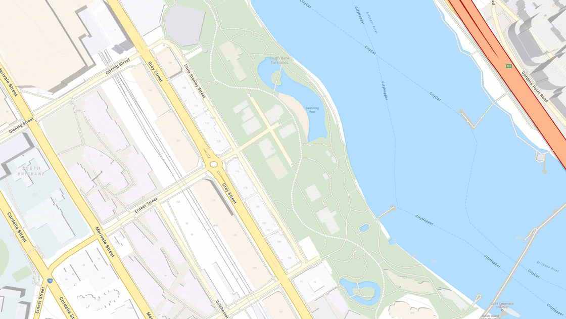 |
|
Image 2 - Before - After: Added busways and their label |
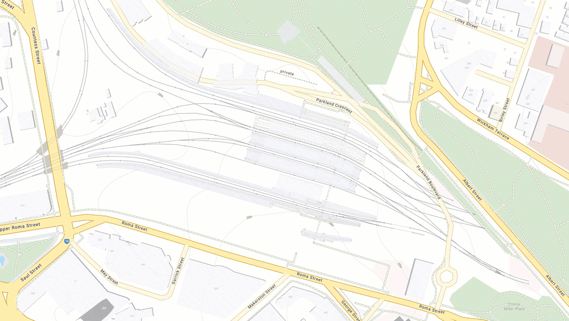 |
|
Image 3 - Before - After: Added Golf Courses/Ranges/Holes |
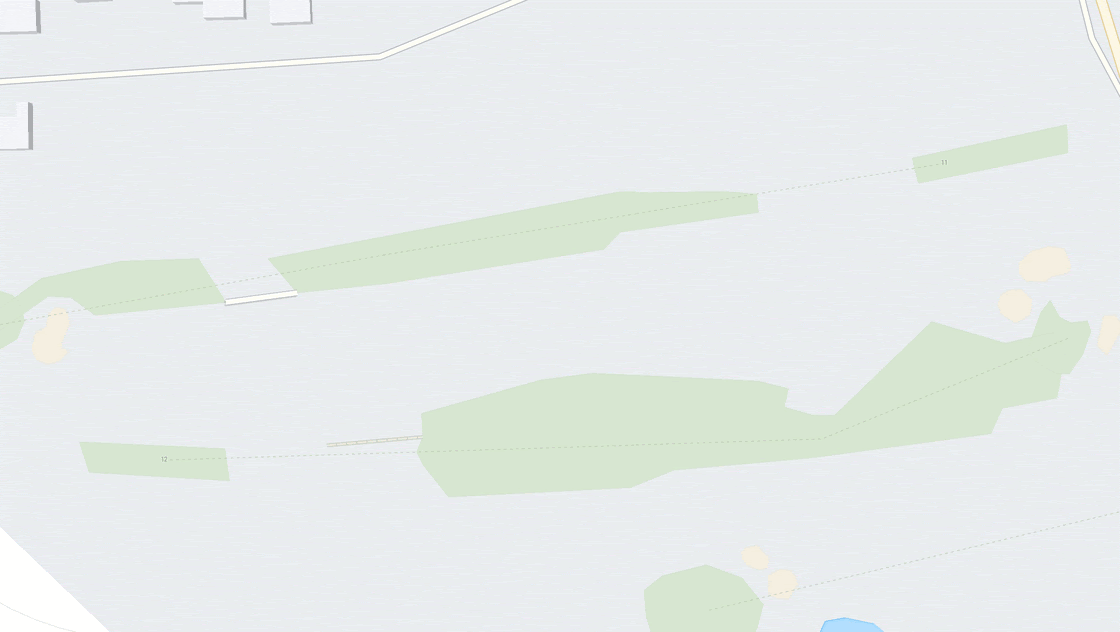 |
|
Image 4 - Before - After: Added Mangroves Layer |
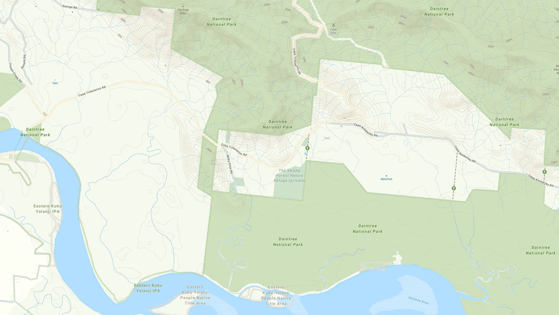 |